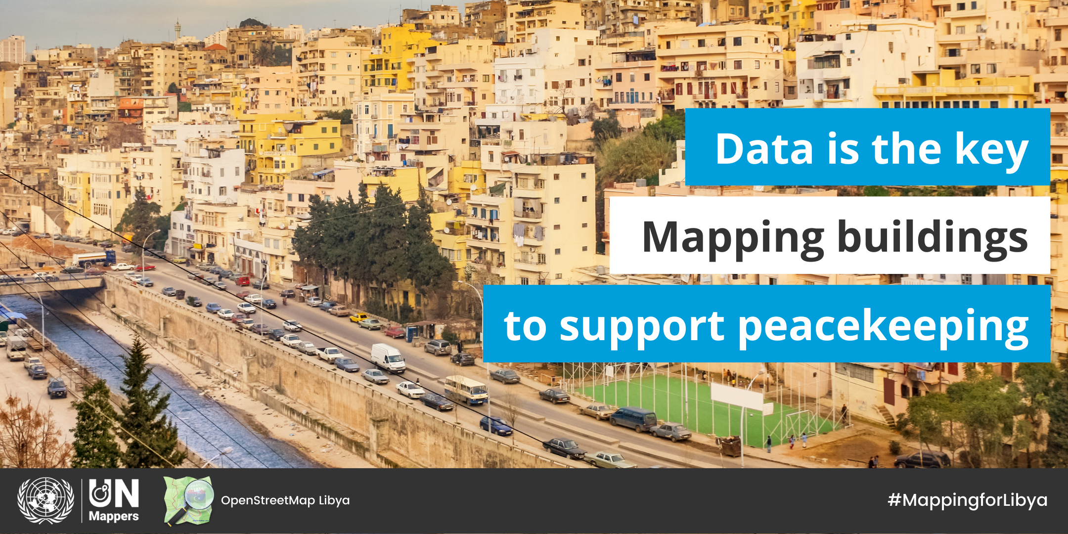
"United Nations for Libya" mapathon
Map with us! UN Mappers and OSM Libya are pleased to invite you to the "United Nations for Libya" mapathon to be held from 20 to 22 May. The aim of the mapathon is to create open geodata regarding buildings in the city of Tripoli, supporting UNSMIL to ensure peace in Libya. The data will be used to deliver a 3D digital replica of the city of Tripoli to allow peacekeepers to remotely visualize and analyze inaccessible locations on the ground, experience different kind of scenarios beforehand, and perform operational planning around a shared simulated sandbox.
The mapathon will be launched on Friday 20th May with a live event from 3:00 to 6:00 pm CEST.
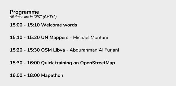
After the event, the mapathon will continue offline until Sunday 22 May. The results will be announced on social networks and by email to all registered participants.
Get your free ticket here: bit.ly/LibyaMapathon
Note that mapping buildings in particular contexts can present some difficulties, due to the height of buildings and the conformation of the urban fabric. Watch this video to learn more about building mapping in OpenStreetMap: