Eurêka Géo Feat UN Mappers - Training on OSM mapping and tools
The training jointly organised by UN Mappers and Eurêka Géo from Cameroon took place from 26th March to 4th May 2021. This 12-hours online training aimed to strengthen the capabilities of the YouthMappers Chapters of Mbalmayo and Douala, Eurêka Géo students and the OpenStreetMap Cameroon community on OSM mapping using JOSM and iD Editor and data collection tools such as Kobo Collect; and to lay the foundations for a long and fruitful collaboration between Eurêka Géo and UN Mappers on future projects.
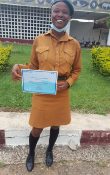
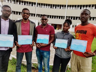
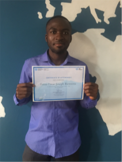
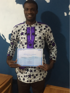
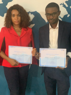
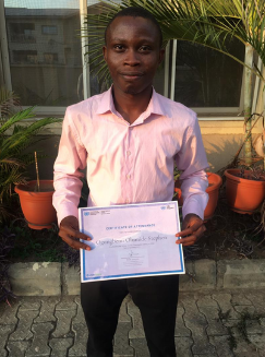
The course focused on aspects of topographic mapping, particularly of residential areas, roads, waterways and land use. Students were able to practice the above by contributing to mapping in Somalia and in Mali, supporting with their edits UNSOS and MINUSMA missions. At the end of the training, attendees who successfully completed the training received a certificate of participation and the work of the course's top two mappers, Carine Moukom and Charly Ebeh, recognized by the UN Mappers team. You can find their story in the Voice of the Community page!
We asked the participants to tell us about their experience:
COLLECTIVE CONSIDERATION by Chapter or Community
YouthMappers Douala
It was amazing collaborating with UN Mappers and Eurêka Géo for a 12-hours topographic editing training course on OpenStreetMap in support of the UN peacekeeping missions. We learned a lot about OpenStreetMap and collaborative mapping. The training was based on mapping topographic features to support the UN peacekeeping missions in their activities around the world and in Africa in particular. During this training, we learnt how to recognise and map residential areas, waterways (hydrology), land cover and so on with both OSM iD editor and JOSM (the advanced editing application). As a group, it was the first time we participated in a collective training using modern technology (e-learning). The experience was awesome and we are ready for new mapping challenges. We had a great time throughout this training especially during the session on waterways. We loved the fact that videos were made available for those who had network issues accompanied with the simplified explanation by our facilitators. We recognize the efforts of UN Mappers and the training offered. We aspire to be better mappers tomorrow in order to create an impact in our society and the young generation in particular with the tool of collaborative mapping.
Eurêka Gêo
For us students at Eurêka Géo, which is a training centre specialized in Geomatics and Spatial technologies, this training course was not only fascinating but also rich in learning. We were already using JOSM for our mapping projects, but tools like iD Editor were new to us and this course allowed us to learn a new editing tool. Likewise the training on Kobo Collect provided us a new data collection tool, to be compared with other data collection tools we use daily.
Beyond mapping we learned about the context of OpenStreetMap, its use and its vision. We take pride in knowing that the data we produce is being used to create maps to facilitate decision-making in war-affected countries.
We were looking for training on using OSM to help solve community crises, especially in Africa. We have been delving into population studies as an elective course during our graduate program, a sign of our interest in people's well-being, seeking to learn more about the situation people frequently face and how to solve those problems. We considered getting the UN training to get a broad vision of this.
This new vision gained from the training has helped us combine our local knowledge and United Nations perspective to solve problems within the African space. As a result, we will be able to assist the population better than before.
Two of our students were awarded as best mappers during the training and their profiles shared in the UN Mappers network, allowing us to have more visibility on an international scale. A recognition that encourages everyone to contribute to OSM.
YouthMappers Mbalmayo
As a newly created chapter, the training on mapping tools such as JOSM, iD Editor, and data collection tools such as Kobo Collect has been exciting. We would like to make the Mbalmayo chapter a national and international reference. Therefore, through this training, we have acquired methodologies for training, digitizing topographic features such as waterways, roads, buildings and land use. These methodologies will be easily applicable in the training courses we undertake in the future and we can easily organize field collection campaigns adapted to the forest context that is our field of study.
OSM Cameroon
As an association promoting the use of open data and OpenStreetMap, this training allowed us to strengthen our skills on the use of iD Editor, JOSM and Kobo Collect Tool, which are tools that we use on a daily basis to respond to specific problems in Cameroon, especially those related to floods.
HOW DID YOU FEEL SUPPORTING PEACEKEEPING WITH UN MAPPERS?
"Supporting the peacekeeping missions with UN Mappers was an opportunity for Youth Mappers Douala to engage in this important task. We hope to use the knowledge gained to impact the lives of many others with the support of UN Mappers. We have always been passionate about humanitarian response, so supporting peacekeeping missions stirred a great sense of fulfillment in us and we remain so grateful for such an amazing privilege free of charge and we pray the chain continues." - YouthMappers Douala
"Peacekeeping with UN Mappers is a humanitarian initiative that has filled our hearts with immense compassion, and above all, allowed us to lend a hand in building the peacekeeping programme in the world." - Eurêka Géo