UN Mappers in support of Türkiye and Syria - Mapping for Emergency Relief
The United Nations Global Service Centre (UNGSC) is at the forefront of adopting state-of-the-art geospatial technology to address UN operational needs. UN Maps was established in 2019 to support the mandates of UN peacekeeping missions and Agencies, Funds and Programmes based on a suite of geospatial solutions and by leveraging both UN-managed and open data sources.
One of the key components of UN Maps is its crowdsourced data collection capability. The UN Mappers community, the volunteer-based mapping community of UN Maps, is composed by more than 4200 volunteers from all over the world and get together through mapping gatherings to trace geospatial features on top of publicly available satellite imagery and provide support to peacekeeping and humanitarian operations. This capability has proven invaluable in humanitarian catastrophes and natural disasters, as the community can produce data quickly and where it is needed the most.
A catastrophic 7.8 magnitude earthquake occurred on February 6th, 2023, along the Türkiye-Syria international border, causing more than 41,000 deaths and leaving thousands of people homeless. UN Mappers promptly activated a collaborative mapping activity on February 10th, 2023, engaging over 400 volunteers who added 17,700 buildings to the map in just a few hours. The community hosted another event with similar results on February 17th, 2023, with a focus on Western Syria.
On one side, most mappers, including newly recruited ones, edited building footprints based on satellite imagery acquired before the earthquake. This was useful in identifying which buildings were present before the disaster. On the other side, a few expert mappers accessed recently-acquired open aerial imagery, such as drone imagery collected by local volunteers, to identify which buildings had collapsed and perform damage assessment.
The data collected played a fundamental role in helping humanitarian actors, including UN AFPs, estimate population densities, map the urban landscape, and plan rescuing efforts. The event showed how open geospatial data enhances collaboration during sudden events, beyond the immediate benefit of data provisioning in emergency relief activities.
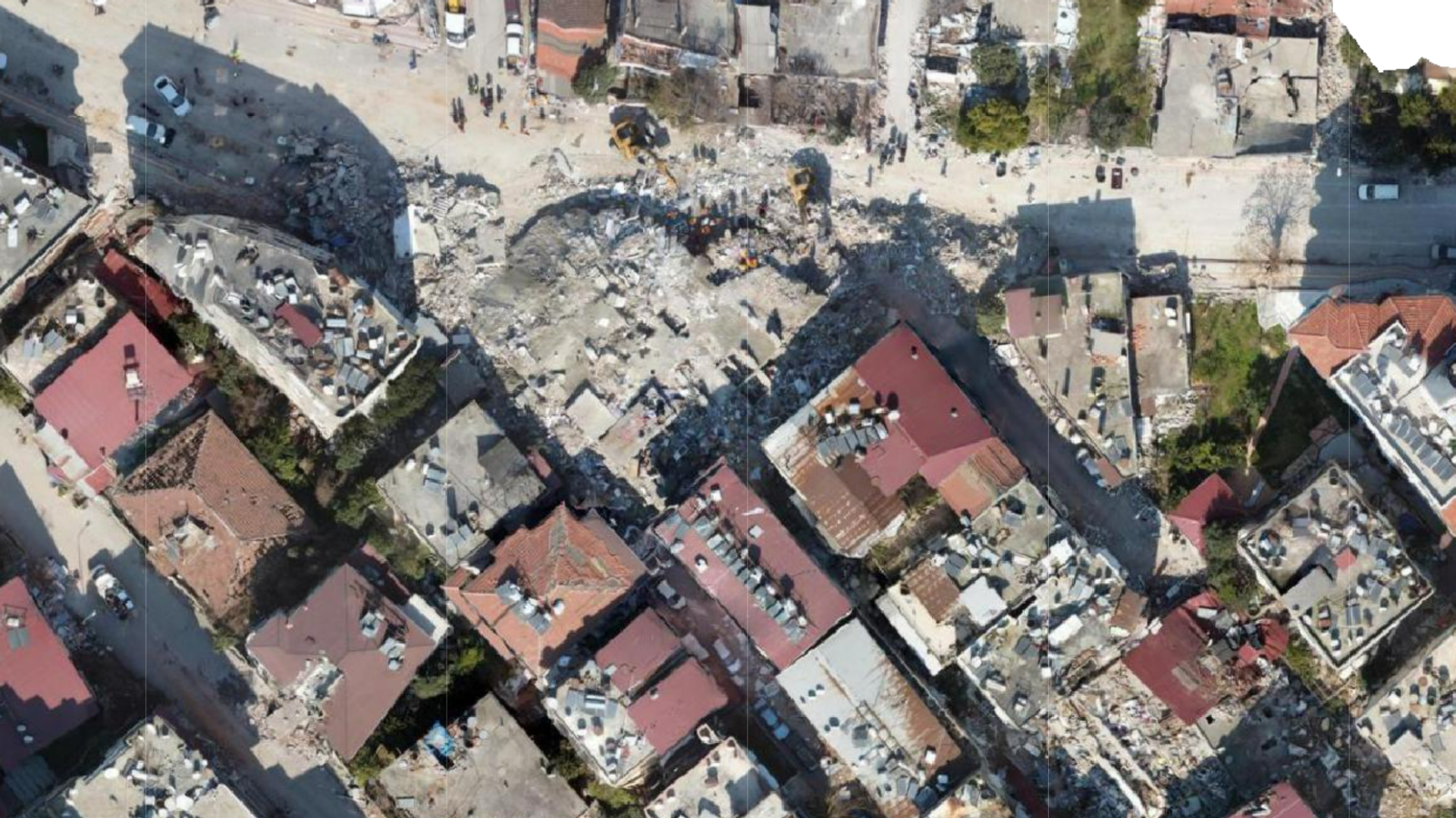
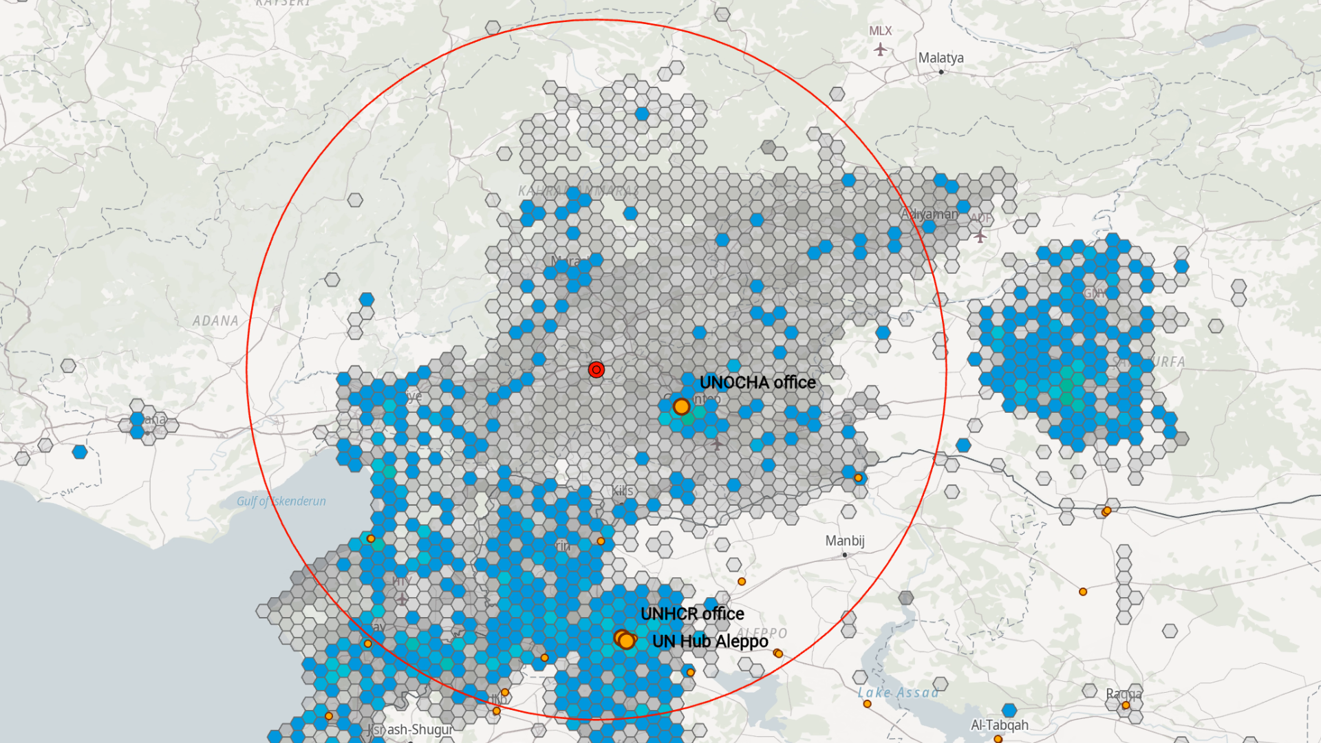
Image 1: Drone image shared publicly by a local volunteer https://map.openaerialmap.org/#/36.14871025085449,36.19930656096562,18/user/63e9ccceca43600005f4d8e5/63eb78a0ca43600005f4d920?_k=fa2aen
Image 2: Map of UN Mappers contributions (blue) with respect to other volunteers (gray). Point symbology: UN and NGOs offices (yellow), earthquake epicenter (red). Scale 1:2,000,000.
© UN Maps, OpenStreetMap contributors