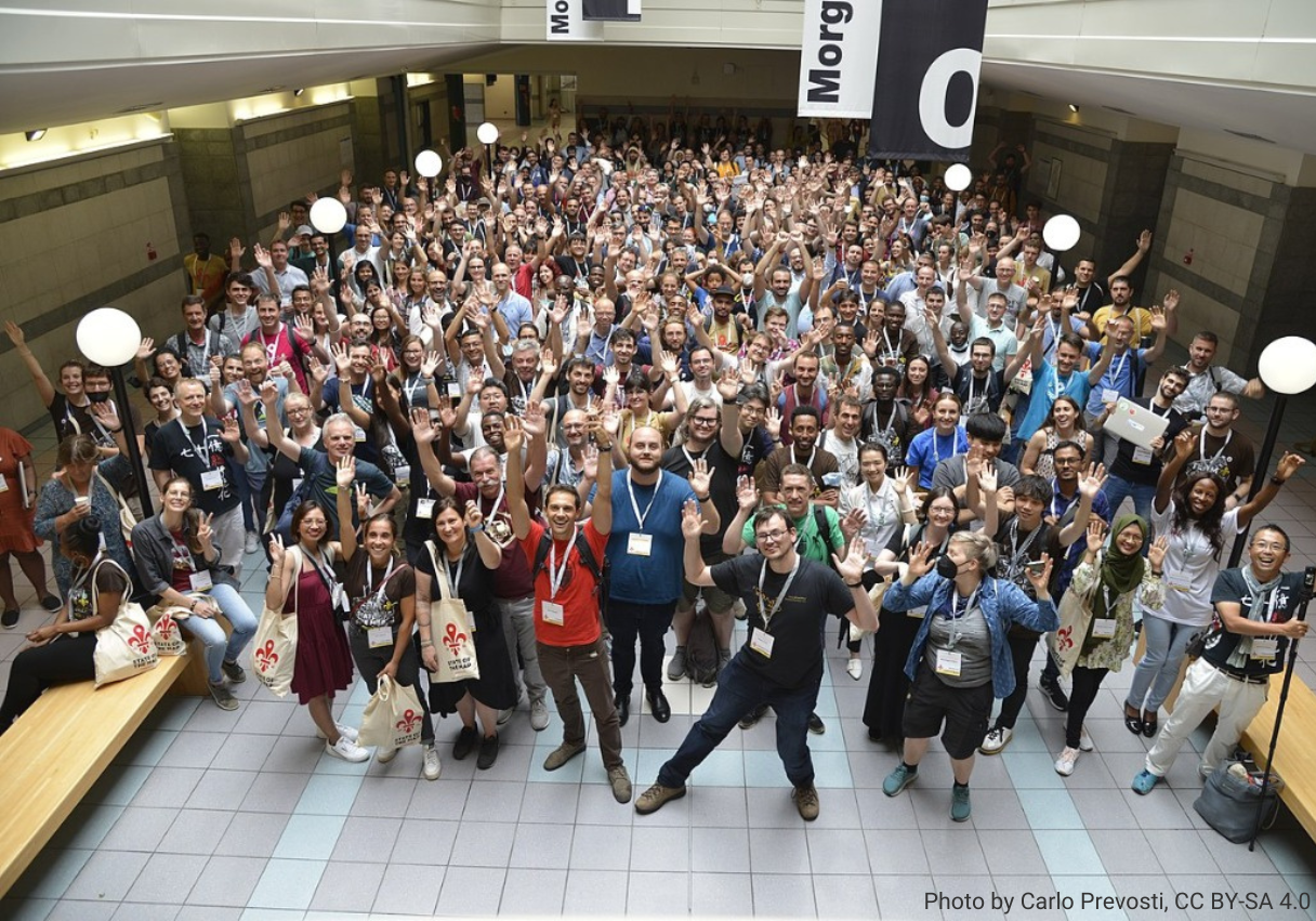
State of the Map in Florence, Italy - August 19-21, 2022
The State of The Map, the annual, global OpenStreetMap conference, held this year in Florence, was an opportunity to present the projects carried out in recent months and the results achieved so far, but it was also a time to meet the large community of mappers and to discuss and deepen with them topics such as the educational aspect. Let's take a look at a summary of what happened during those days!
Panel on Educational initiatives and platforms on OpenStreetMap: making open data more accessible
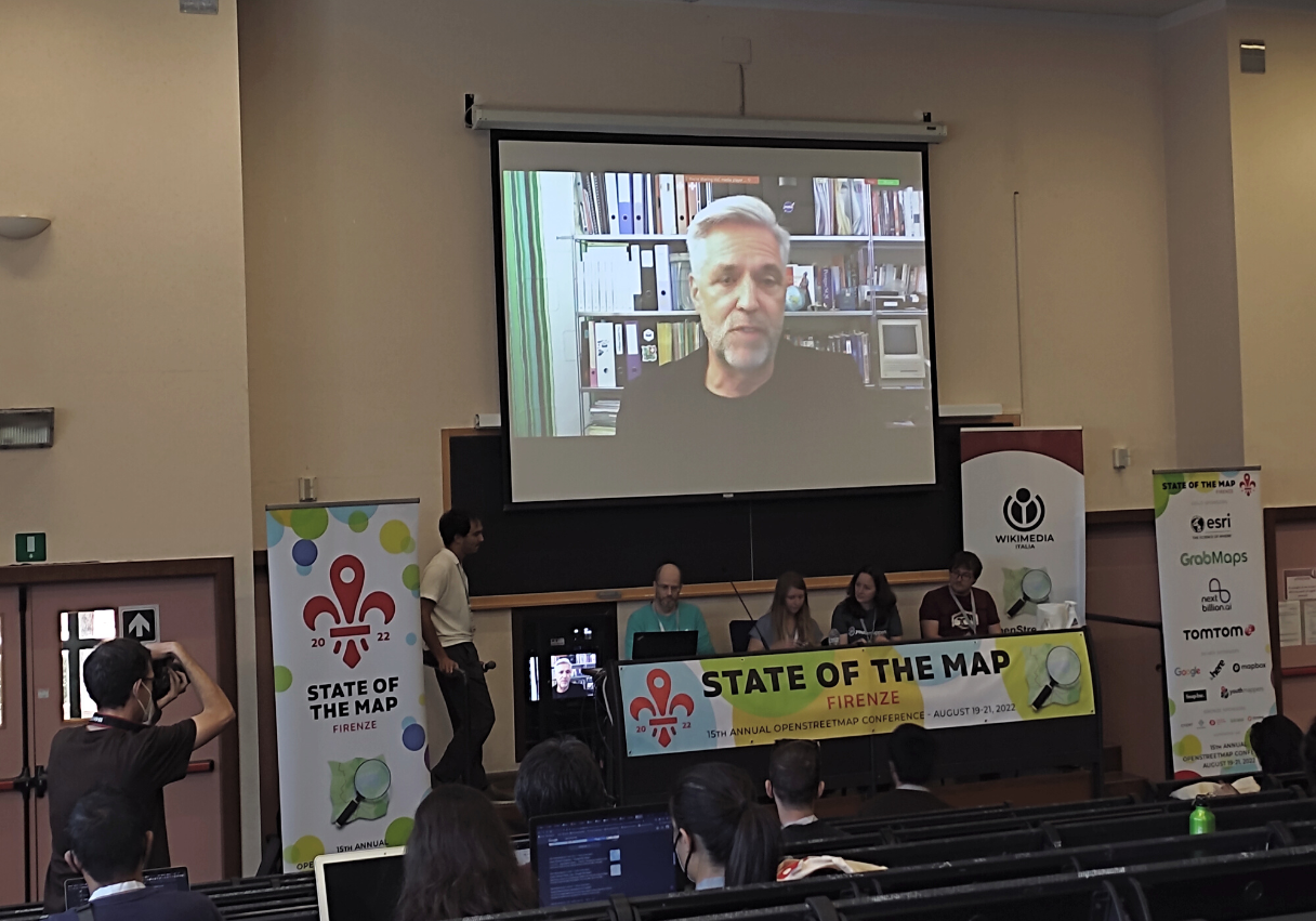
Panelists: Jess Beutler (OSM US, TeachOSM) Severin Menard (UN Mappers), Nuala Cowan (YouthMappers), Benjamin Herfort (GIScience Heidelberg), Michael Montani (UN Mappers). With the remote contribution of Stefan Keller (OpenSchoolMaps), Madalina Ionescu (Humanitarian OpenStreetMap Erasmus+ Students), and Nathalie Sidibe (OSM Mali).
OpenStreetMap is a huge repository of geographic information – but how accessible is it? With this question as a starting point, during the panel organized on Saturday 20 August, we had the opportunity to explore, together with the panelists and the audience, the current situation of education in OpenStreetMap: which tools are available, the challenges still to be faced and possible solutions. The goal was to enlist and explore all the tools and activities that organizations and communities are developing around education on OSM, with a particular focus on the audience covered by those as well as the languages this material is offered through.
Despite the efforts made and the great work done so far to provide quality educational material by the various communities and organizations, the room for improvement remains wide and the open questions are many. How, for example, to facilitate training in underdeveloped countries where English is not widespread and where access to the Internet is not a given? Which platforms should be used to involve the largest number of users?
Another question raised concerns the purposes with which a training opportunity takes place and the ethical aspect behind it: Why do you train a mapper? Do you only want to train people, or do you want to educate them? The difference, although seemingly irrelevant, is very important here, especially when it comes to projects in schools. Educational projects should aim to provide students with new skills and abilities that they can put into their personal career toolbox, beyond the editing purposes that the project might have.
In this sense, the need to list the topics that an OSM course should cover, so as to have a standardization of educational material, also emerged; as well as the creation of a platform to connect a plethora of stakeholders, ranging from simply interested contributors to schoolteachers, with educators offering online real-time mentoring or on-site training was proposed.
On this point, the suggestion was made to create an Education working group within the OSMF, which could serve as a reference point for those engaged in this field.
Among the topics touched upon during the panel there has been the question on the sources current mappers use to train themselves and how important gamification in bringing new users to mapping, as happens in successful projects as MapSwipe or StreetComplete.
Watch the talk (link)
UN Maps Learning Hub launch
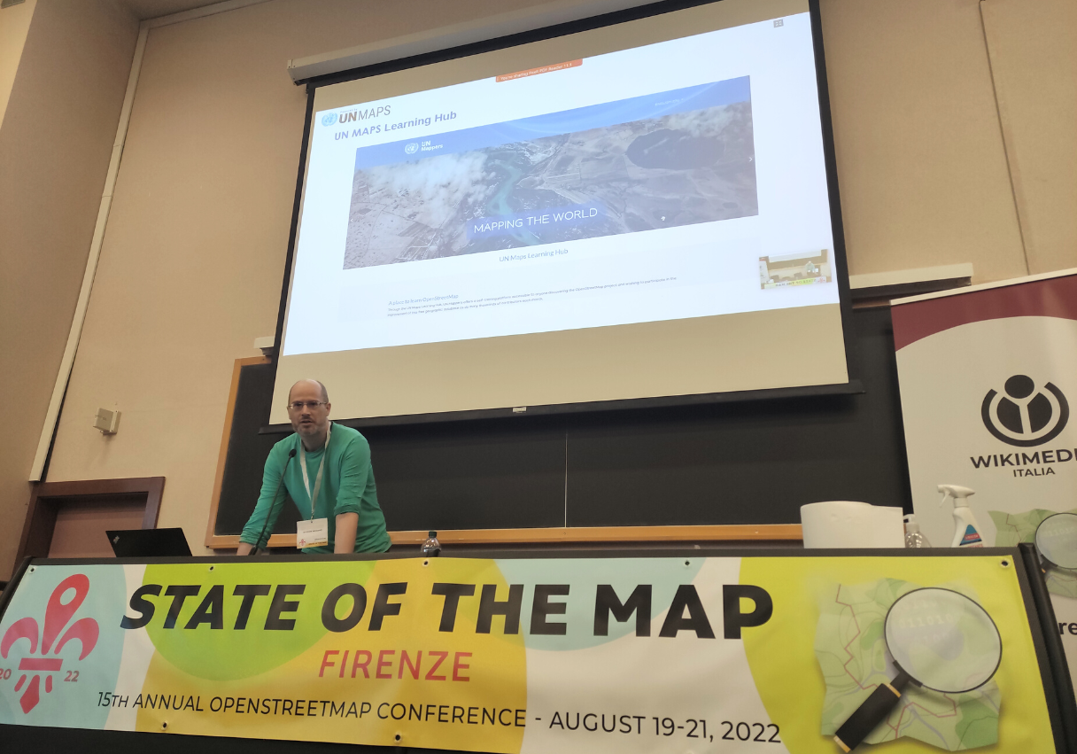
During the Lightning talks session on Friday, we launched the UN Maps Learning Hub. The Learning Hub, which is based on the open-source Moodle framework, aims to educate mappers, both beginners and experts, in OpenStreetMap editing with a focus on topographic mapping. At the moment, the only available course is “OSM Basics”, in which are covered topics such as opening an OSM account, how to use the main OSM editors, and mapping topographical features such as settlements, road networks, and waterways, considering the geographical context in which they are located. It is possible in each section to test the knowledge acquired through quizzes.
The UN Maps Learning Hub is open to everybody, free of charge, and the materials are currently available in 5 languages: English, Spanish, French, Italian and Portuguese. The material is also downloadable, to facilitate those with Internet connection problems.
The creation of new courses and the implementation of other languages are planned for the coming months. If you or your community are interested in translating the material into a language not currently available, please contact us at mappers@un.org!
Crowdsourcing and virtual reality applications for peacekeeping: study cases in Mogadishu and Tripoli
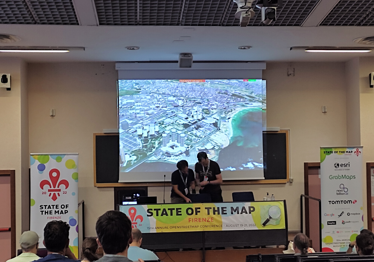
During this session we presented how, through the Virtual Operation Center (VOC) pilot project, the United Nations Global Service Center UNGSC aims to provide UN peacekeepers on the field with 3D digital replicas of the cities in which they are operating, building a sandbox that enhances operational planning with simulations. Thanks to the UN Mappers community, the areas of interest get mapped by means of Tasking Manager projects, producing building footprints on OpenStreetMap.
Unlike other building mapping campaigns, those are different, as higher quality of the footprints is needed, as well as better placement at the ground-floor level and clear understanding of tall buildings. Furthermore, mapping can be complemented with field mapping either through street-level imagery and smartphone applications, in order to add details on the buildings characteristics such as height, levels, roof shape, color and material.
After validation of all the edited data, the buildings are ingested into Virtual Reality and 3D Design software development tools such as ArcGIS CityEngine, Maya and Unity to develop the sandbox application accessible through VR headset. Buildings get eventually rendered utilizing OSM tags which define the 3D model of each object.
The activity has been already tested and developed in Mogadishu, Somalia, and Tripoli, Libya, where the mapping took place engaging with the local communities (OSM Somalia, YouthMappers at Somali National University and OSM Libya).
Watch the talk (link)
Poster session
In addition, you can take a look at the two UN Mappers posters displayed at the event here: