Mapping Streetlights: an open data approach to analyze campus safety
A group of students enrolled in the Erasmus Mundus Master’s program in Geospatial Technologies at the University of Jaume I (UJI) in Castellón de la Plana, Spain, as part of their final class exercises for the course “Spatial Data Services,Sources,Standards and Infrastructures” analysed campus safety and identified vulnerabilities mapping campus streetlights, utilizing open data and GIS software.
The student's inspiration came from a representative of UN Mappers, who introduced the class to OpenStreetMap (OSM) and humanitarian mapping during a workshop held in November 2022. With this knowledge, students were able to find the data needed for the ‘Safe City’ final course exercise.
Finding that any citizen can contribute to OSM, they headed into the field to map streetlamps across the university campus ourselves! Using Every Door mobile app, the team collected the coordinates and attribute data of 250 lamp stands on campus and uploaded it to the OSM database.
The team encountered a moment of distress when there was a concern that the data had been missed in the cloud, but to their relief, they were able to retrieve the data using Java OpenStreetMap Editor (JOSM) desktop software . Also, it was possible to transform, clean, and prepare the data for geospatial processing in a GIS environment using interoperable software that accepts the OSM data format.
With the data ready, the team set out to answer two important questions:
1) How do we map out dark spots on the campus?
2) How do we calculate the size of the lit area on campus?
The students used GIS analysis to determine the illumination extent of each lamp across the entire campus, taking into consideration the effects of the buildings, which could obstruct illumination, to calculate the true illuminated area of the campus and identify dark spots by overlay analysis.
The analysis showed that the illuminated area of the university covers a total area of 111,620 square meters. This collaborative effort sheds light on the dark spots of the campus but also highlights the importance of citizen participation in contributing to open data platforms such as OSM and the use of GIS software for data interoperability and geospatial processing. The work showcased how students can make a significant impact on campus and beyond by contributing to open data platforms, using Volunteered Geographic Information and GIS technology. Collaboratively mapping streetlights can promote safety and aesthetics, foster citizen participation, and build a better world for all.
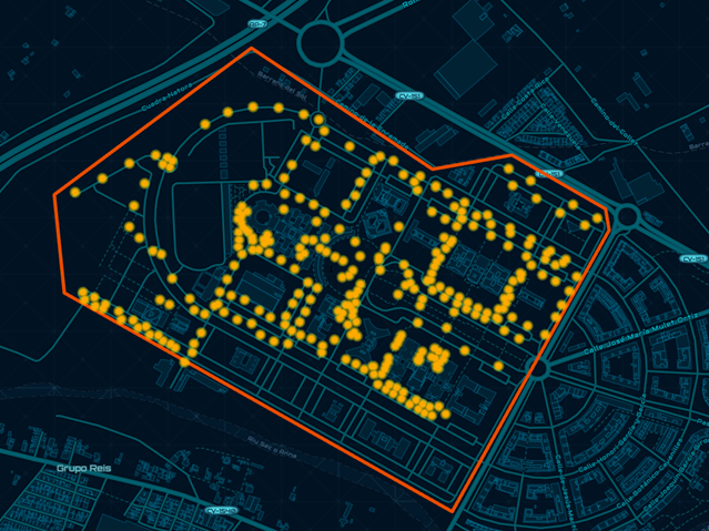
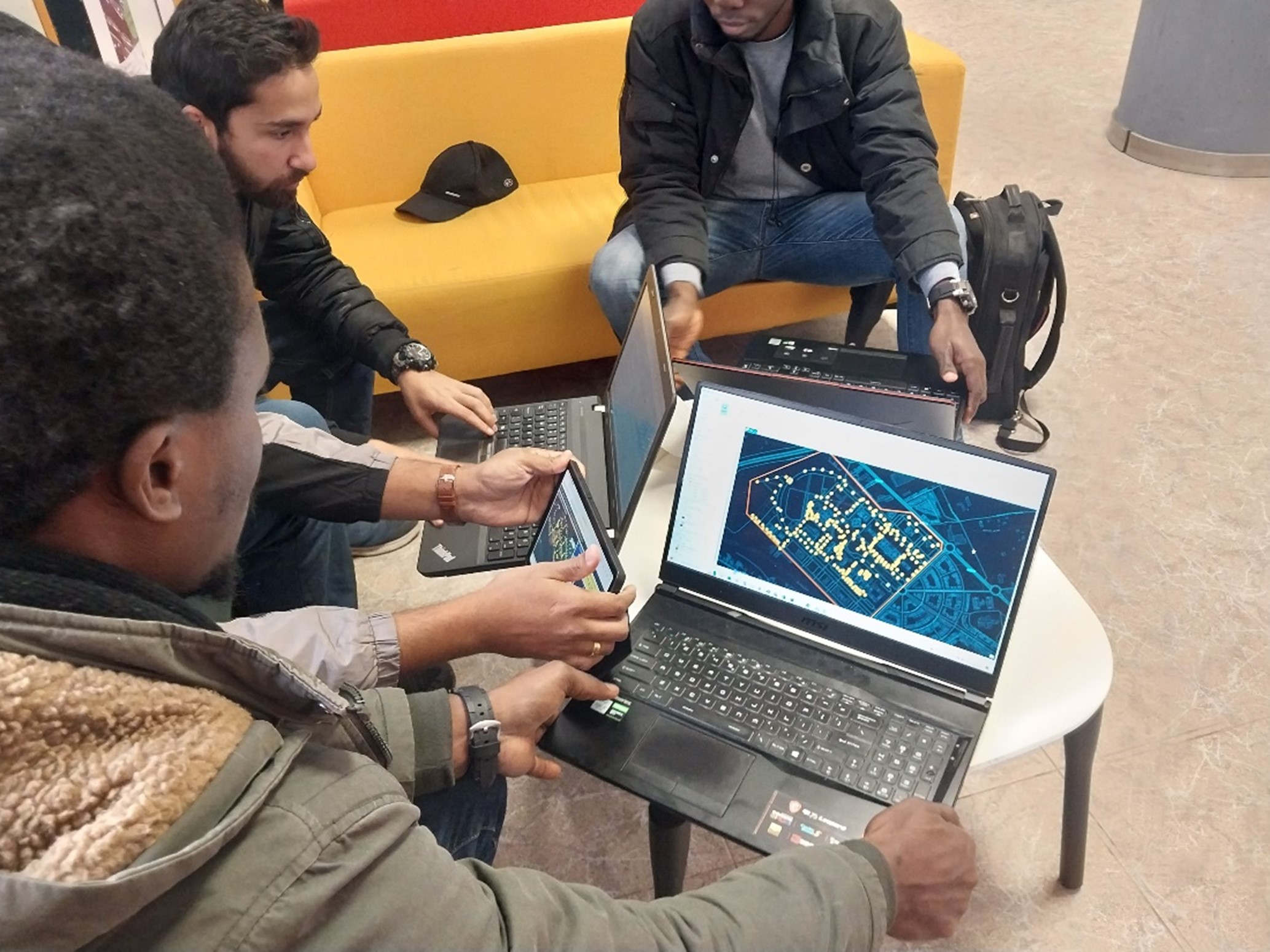
The area of the campus with the streetlights that were mapped during the field survey.
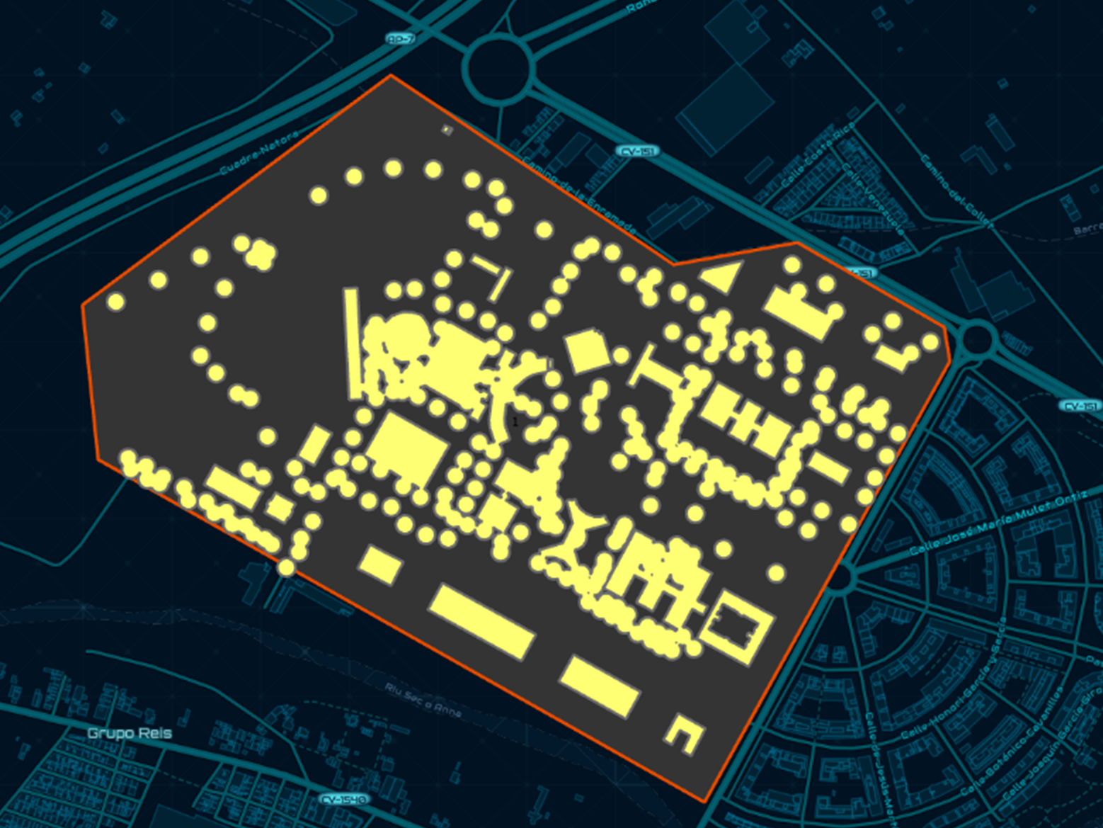
The analysis showed that an area equal to 69.8% of the analysed area (422,008 square meters out of a total of 604,458) is unlit.
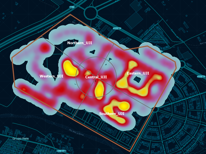
The heat map of the analysis shows a general concentration of lamps in the southern and central UJI zones. The northern and Eastern UJI zones show a sparse distribution of lamps, and the darker portions of the university are located in the Northern UJI.
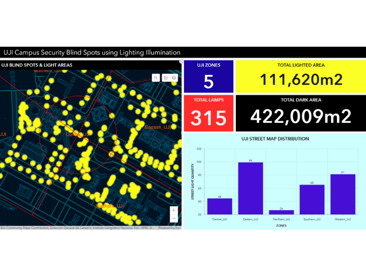
A dashboard displaying the results of the mapping activity
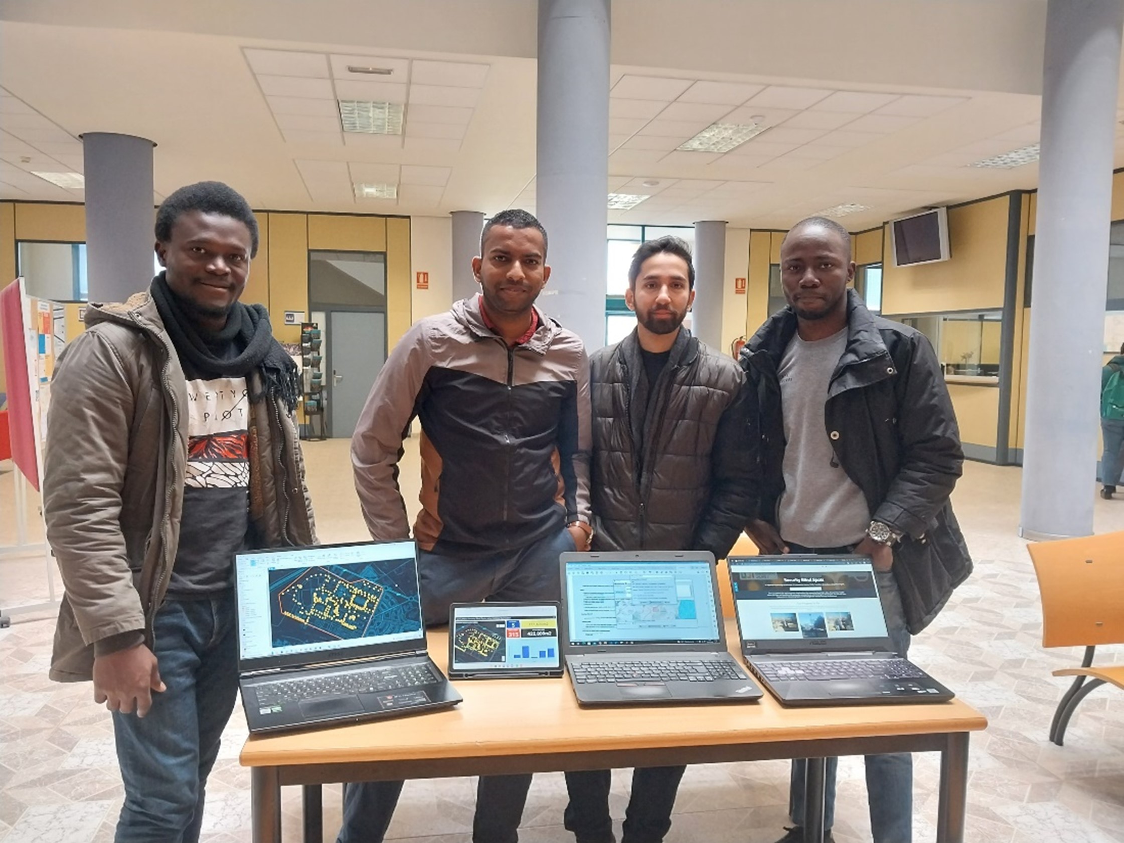
Team Members
Onyeukwu Nnadozie Uzoma
Prasad Madushanka Douglass Dambure Liyanage
Oluwatobi Ezekiel Adefisan
Muhammad Omar Khan
Resources
Dashboard
https://uji.maps.arcgis.com/apps/dashboards/456e7c8ef68c45279a5ee7df5ccacc5b
GIS HUB
https://security-blind-spots-uji.hub.arcgis.com/
WEB Map
https://uji.maps.arcgis.com/home/item.html?id=56cacd105b4e4b6988599fa76ed5348a
Credits: Data © OpenStreetMap contributors , Software: JOSM, ESRI ArcGIS